Tim G
Well-Known Member
Tropical Storm Frances Intermediate Advisory Number 50a
Issued at: 7:33 AM EDT 9/6/04
Frances heading for the Florida panhandle, air force plane finds no change in strength,
A hurricane warning remains in effect for the northwest gulf coast of Florida from anna maria island northward to destin.
A tropical storm warning is now in effect for the Florida west coast from south of anna maria island to englewood, and along the Florida east coast and the georgia coast from cocoa beach Florida northward to altamaha sound georgia.
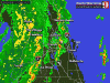
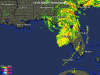
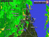
At 8 am edt, 1200z, the center of tropical storm frances was located near latitude 29.1 north, longitude 83.6 west or about 110 miles, east-southeast of apalachicola Florida.
Frances has been drifting northward for the past couple of hours but a general track toward the northwest about 12 mph is expected today. On this track, the center of frances should continue moving over the northeastern gulf of mexico, and make landfall over the central portion of the Florida panhandle by this evening.
Maximum sustained winds remain near 65 mph, with higher gusts. Some strengthening is possible during the next 12 hours, and frances could become a hurricane again just before landfall occurs.
Frances remains a large tropical cyclone with tropical storm force winds extend outward up to 200 miles from the center, especially to the northeast. Cedar key recently reported wind gusts to 52 mph.
The minimum central pressure reported by an air force reconnaissance plane was 980 mb, 28.94 inches.
Coastal storm surge flooding along with large and dangerous battering waves continue along the north Florida east coast, but will gradually subside later today. Along the southwest Florida coast, storm surge flooding of 2 to 4 feet above normal tide levels is expected south of cedar key. Storm surge flooding of 6 to 10 feet above normal tide levels is expected along the northeast gulf coast of Florida to the north of cedar key, especially at the head of apalachee bay.
Rainfall amounts of 6 to 10 inches, with locally higher amounts, are expected over portions of the southeastern united states, especially along and to the east of the wide path of frances.
Isolated tornadoes are possible today over portions of northern florida and the Florida panhandle, southeast alabama and southern georgia.
Repeating the 8 am edt position, 29.1 n, 83.6 w. Movement drifting northward. Maximum sustained winds, 65 mph. Minimum central pressure, 980 mb.
For storm information specific to your area, please monitor products issued by your local weather office.
The next advisory will be issued by the nationalhurricane center at 11 am edt.
Issued at: 7:33 AM EDT 9/6/04
Frances heading for the Florida panhandle, air force plane finds no change in strength,
A hurricane warning remains in effect for the northwest gulf coast of Florida from anna maria island northward to destin.
A tropical storm warning is now in effect for the Florida west coast from south of anna maria island to englewood, and along the Florida east coast and the georgia coast from cocoa beach Florida northward to altamaha sound georgia.
At 8 am edt, 1200z, the center of tropical storm frances was located near latitude 29.1 north, longitude 83.6 west or about 110 miles, east-southeast of apalachicola Florida.
Frances has been drifting northward for the past couple of hours but a general track toward the northwest about 12 mph is expected today. On this track, the center of frances should continue moving over the northeastern gulf of mexico, and make landfall over the central portion of the Florida panhandle by this evening.
Maximum sustained winds remain near 65 mph, with higher gusts. Some strengthening is possible during the next 12 hours, and frances could become a hurricane again just before landfall occurs.
Frances remains a large tropical cyclone with tropical storm force winds extend outward up to 200 miles from the center, especially to the northeast. Cedar key recently reported wind gusts to 52 mph.
The minimum central pressure reported by an air force reconnaissance plane was 980 mb, 28.94 inches.
Coastal storm surge flooding along with large and dangerous battering waves continue along the north Florida east coast, but will gradually subside later today. Along the southwest Florida coast, storm surge flooding of 2 to 4 feet above normal tide levels is expected south of cedar key. Storm surge flooding of 6 to 10 feet above normal tide levels is expected along the northeast gulf coast of Florida to the north of cedar key, especially at the head of apalachee bay.
Rainfall amounts of 6 to 10 inches, with locally higher amounts, are expected over portions of the southeastern united states, especially along and to the east of the wide path of frances.
Isolated tornadoes are possible today over portions of northern florida and the Florida panhandle, southeast alabama and southern georgia.
Repeating the 8 am edt position, 29.1 n, 83.6 w. Movement drifting northward. Maximum sustained winds, 65 mph. Minimum central pressure, 980 mb.
For storm information specific to your area, please monitor products issued by your local weather office.
The next advisory will be issued by the nationalhurricane center at 11 am edt.


")