I updated the title for now, and will reupdate it when the storm is officially named.We should probably have the title of this thread updated to reflect the storm name and perhaps the month/year. Otherwise it becomes a catch-all.
-
Welcome to the WDWMAGIC.COM Forums!
Please take a look around, and feel free to sign up and join the community.
You are using an out of date browser. It may not display this or other websites correctly.
You should upgrade or use an alternative browser.
You should upgrade or use an alternative browser.
Hurricane Helene (2024)
- Thread starter Gringrinngghost
- Start date
JohnD
Well-Known Member
Unless another low pressure system becomes a tropical storm before this one, it will be Helene. But it isn't now so the thread is still correctly named.I updated the title for now, and will reupdate it when the storm is officially named.
Now do I write it as Helene or use the pronunciation guide and do it phonetically: heh-LEEN.Unless another low pressure system becomes a tropical storm before this one, it will be Helene. But it isn't now so the thread is still correctly named.
JohnD
Well-Known Member
Or is it HELL-EEN.Now do I write it as Helene or use the pronunciation guide and do it phonetically: heh-LEEN.
Ayla
Well-Known Member
Huh-leen.Or is it HELL-EEN.
JohnD
Well-Known Member
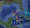
At first I thought this was a wacky spaghetti model then I realized it was "hurricane hunter" flight paths.We are finally getting a lot of the much needed data to help with the forecasting today. Gonzo and a WC-130J did a lot of synoptic surveillance this morning.
View attachment 817616
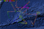
We have two additional flights into the system underway, a WC-130J and Mrs. Piggy.
View attachment 817617
NHC has heh-LEEN
JohnD
Well-Known Member
Huh?Huh-leen.
It's actually Hurricane Hunter recon dataAt first I thought this was a wacky spaghetti model then I realized it was "hurricane hunter" flight paths.
Huh?Better just to spell it out and let others figure out the pronunciation.
danlb_2000
Premium Member
I’m here myself till Friday so well aware. Just saying we have people always making wild predictions every time there’s the possibility of a hurricane, and viewers of this thread trying to figure things out for their trip should be reminded that everything posted here is speculative. Heck last time we had people recommending people look up where storm shelters were for what turned out to be a wet afternoon.
Prepare for the worst and hope for the best.
I would not expect a 10am arrival on Wednesday to be impacted.Hoping our arriving flight of 10 AM tomorrow will be early enough to not have to deal with any delays or cancellations.
You will be fine.Hoping our arriving flight of 10 AM tomorrow will be early enough to not have to deal with any delays or cancellations.
Helene has been named. Stand by for the advisory.
Ayla
Well-Known Member
It was just released.Helene has been named. Stand by for the advisory.
Code:
062
WTNT34 KNHC 241458
TCPAT4

BULLETIN
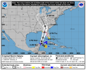
Tropical Storm Helene Advisory Number   5
NWS National Hurricane Center Miami FL       AL092024
1100 AM EDT Tue Sep 24 2024

...TROPICAL STORM HELENE FORMS OVER THE NORTHWESTERN CARIBBEAN
SEA...
...HURRICANE AND STORM SURGE WATCHES REMAIN IN EFFECT FOR PORTIONS
OF THE FLORIDA GULF COAST...


SUMMARY OF 1100 AM EDT...1500 UTC...INFORMATION
-----------------------------------------------
LOCATION...19.5N 84.3W
ABOUT 180 MI...295 KM ESE OF COZUMEL MEXICO
ABOUT 170 MI...275 KM SSE OF THE WESTERN TIP OF CUBA
MAXIMUM SUSTAINED WINDS...45 MPH...75 KM/H
PRESENT MOVEMENT...NW OR 310 DEGREES AT 12 MPH...19 KM/H
MINIMUM CENTRAL PRESSURE...1000 MB...29.53 INCHES


WATCHES AND WARNINGS
--------------------
CHANGES WITH THIS ADVISORY:

A Tropical Storm Warning has been issued for the Lower Florida Keys
west of the Seven Mile Bridge and for the Dry Tortugas.

A Tropical Storm Watch has been issued for the Middle Florida Keys
from the Seven Mile Bridge to the Channel 5 Bridge.

SUMMARY OF WATCHES AND WARNINGS IN EFFECT:

A Storm Surge Watch is in effect for...
* Indian Pass southward to Flamingo
* Tampa Bay
* Charlotte Harbor

A Hurricane Watch is in effect for...
* Cabo Catoche to Tulum, Mexico
* Cuban province of Pinar del Rio
* Englewood to Indian Pass
* Tampa Bay

A Tropical Storm Warning is in effect for...
* Dry Tortugas
* Lower Florida Keys west of the Seven Mile Bridge
* Grand Cayman
* Rio Lagartos to Tulum, Mexico
* Cuban provinces of Artemisa, Pinar del Rio, and the Isle of Youth

A Tropical Storm Watch is in effect for...
* Middle Florida Keys from the Seven Mile Bridge to the Channel 5
Bridge
* Flamingo to south of Englewood
* West of Indian Pass to Walton Bay County line

A Storm Surge Watch means there is a possibility of life-
threatening inundation, from rising water moving inland from the
coastline, in the indicated locations during the next 48 hours.
For a depiction of areas at risk, please see the National Weather
Service Storm Surge Watch/Warning Graphic, available at
hurricanes.gov.

A Tropical Storm Warning means that tropical storm conditions are
expected somewhere within the warning area within the next 36 hours.

A Hurricane Watch means that hurricane conditions are possible
within the watch area.  A watch is typically issued 48 hours
before the anticipated first occurrence of tropical-storm-force
winds, conditions that make outside preparations difficult or
dangerous.

A Tropical Storm Watch means that tropical storm conditions are
possible within the watch area, generally within 48 hours.

Wind and storm surge warnings will likely be required for the
U.S. later today.

For storm information specific to your area in the United
States, including possible inland watches and warnings, please
monitor products issued by your local National Weather Service
forecast office. For storm information specific to your area
outside of the United States, please monitor products issued by
your national meteorological service.


DISCUSSION AND OUTLOOK
----------------------
At 1100 AM EDT (1500 UTC), the center of Tropical Storm Helene was
located near latitude 19.5 North, longitude 84.3 West.  Helene is
moving toward the northwest near 12 mph (19 km/h), and this
general motion is expected to continue through early Wednesday.  A
northward to north-northeastward motion at a faster forward speed
is expected on Wednesday and Thursday.  On the forecast track, the
center of Helene will move across the far northwestern Caribbean
Sea through tonight, and then move across the eastern Gulf of
Mexico Wednesday and Thursday, potentially reaching the Gulf coast
of Florida late Thursday.

Data from an Air Force Reserve Hurricane Hunter aircraft indicate
that the system has acquired a well-defined center of circulation,
and maximum sustained winds have increased to near 45 mph (75 km/h)
with higher gusts.  Additional strengthening is forecast, and
Helene is expected to become a hurricane on Wednesday.  Continued
strengthening is anticipated after that time, and Helene could
become a major hurricane on Thursday.

Tropical-storm-force winds extend outward up to 140 miles (220 km)
to the east of the center.

Data from the Hurricane Hunter aircraft indicate that the minimum
central pressure is 1000 mb (29.53 inches).


HAZARDS AFFECTING LAND
----------------------
Key Messages for Helene can be found in the Tropical Cyclone
Discussion under AWIPS header MIATCDAT4 and WMO header WTNT44 KNHC
and on the web at hurricanes.gov/text/MIATCDAT4.shtml

RAINFALL: Helene is expected to produce total rain accumulations of
4 to 8 inches over western Cuba and the Cayman Islands with isolated
totals around 12 inches. Over the eastern Yucatan Peninsula, 4 to 6
inches of rain are expected with isolated totals over 8 inches. This
rainfall brings a risk of considerable flooding.

Over the Southeastern U.S., Helene is expected to produce total rain
accumulations of 4 to 8 inches with isolated totals around 12
inches. This rainfall will likely result in areas of considerable
flash and urban flooding, with minor to moderate river flooding
likely, and isolated major river flooding possible.

For a complete depiction of forecast rainfall associated with
Helene, please see the National Weather Service Storm Total Rainfall
Graphic, available at hurricanes.gov/graphics_at4.shtml?rainqpf and
the Flash Flood Risk graphic at
hurricanes.gov/graphics_at4.shtml?ero.

STORM SURGE: The combination of a dangerous storm surge and the
tide will cause normally dry areas near the coast to be flooded by
rising waters moving inland from the shoreline.  The water could
reach the following heights above ground somewhere in the indicated
areas if the peak surge occurs at the time of high tide...

Ochlockonee River, FL to Chassahowitzka, FL...10-15 ft
Chassahowitzka, FL to Anclote River, FL...6-10 ft
Indian Pass, FL to Ochlockonee River, FL...5-10 ft
Anclote River, FL to Middle of Longboat Key, FL...5-8 ft
Tampa Bay...5-8 ft
Middle of Longboat Key, FL to Englewood, FL...4-7 ft
Englewood, FL to Bonita Beach, FL...3-5 ft
Charlotte Harbor...3-5 ft

For a complete depiction of areas at risk of storm surge inundation,
please see the National Weather Service Peak Storm Surge Graphic,
available at hurricanes.gov/graphics_at4.shtml?peakSurge.

Storm surge could raise water levels by as much as 2 to 4 feet above
normal tide levels in areas of onshore winds along the southern
coast of Pinar del Rio, Cuba, including the Isle of Youth.

Storm surge could raise water levels by as much as 2 to 4 feet above
ground level in areas of onshore winds within the warning area along
the east coast of the Yucatan Peninsula.

WIND: Hurricane conditions are possible within the watch areas in
Cuba and Mexico by early Wednesday.  Hurricane conditions are
possible within the U.S. watch areas Wednesday night and early
Thursday.  Tropical storm conditions are expected in the warning
areas in the Cayman Islands, Cuba, and Mexico today.  Tropical
storm conditions are expected in the warning area in the Lower
Florida Keys beginning on Wednesday, and are possible in the watch
area in the Middle Florida Keys beginning late Wednesday.

SURF: Swells generated by Helene will affect the southern coast
of Cuba and the Yucatan Peninsula of Mexico during the next couple
of days.  Swells will spread northward toward the west coast of
Florida and the northeastern Gulf Coast on Wednesday and Thursday.
These swells are likely to cause life-threatening surf and rip
current conditions.  Please consult products from your local weather
office.


NEXT ADVISORY
-------------
Next intermediate advisory at 200 PM EDT.
Next complete advisory at 500 PM EDT.

$$
Forecaster BergI saw it on my RSS feed.It was just released.
Register on WDWMAGIC. This sidebar will go away, and you'll see fewer ads.


