-
Welcome to the WDWMAGIC.COM Forums!
Please take a look around, and feel free to sign up and join the community.
You are using an out of date browser. It may not display this or other websites correctly.
You should upgrade or use an alternative browser.
You should upgrade or use an alternative browser.
Hurricane Helene (2024)
- Thread starter Gringrinngghost
- Start date

Captain Barbossa
Well-Known Member
5pm update:

Disney Analyst
Well-Known Member
Stay safe everyone, sending positivity and love from your northern neighbour.
Vacationeer
Well-Known Member
- In the Parks
- No
I was hoping to get stuck at AK and buy today’s Enchanted Extra: Sleeping with the Rhinos
Code:
618
WTNT34 KNHC 262042
TCPAT4

BULLETIN
Hurricane Helene Advisory Number  14
NWS National Hurricane Center Miami FL       AL092024
500 PM EDT Thu Sep 26 2024

...HELENE IS A VERY DANGEROUS AND LARGE MAJOR HURRICANE...
...DAMAGING HURRICANE WINDS AND CATASTROPHIC STORM SURGE
EXPECTED TO BEGIN IN THE FLORIDA BIG BEND THIS EVENING...


SUMMARY OF 500 PM EDT...2100 UTC...INFORMATION
----------------------------------------------
LOCATION...27.9N 84.6W
ABOUT 130 MI...205 KM W OF TAMPA FLORIDA
ABOUT 175 MI...280 KM S OF TALLAHASSEE FLORIDA
MAXIMUM SUSTAINED WINDS...125 MPH...205 KM/H
PRESENT MOVEMENT...NNE OR 25 DEGREES AT 23 MPH...37 KM/H
MINIMUM CENTRAL PRESSURE...951 MB...28.09 INCHES


WATCHES AND WARNINGS
--------------------
CHANGES WITH THIS ADVISORY:

None

SUMMARY OF WATCHES AND WARNINGS IN EFFECT:

A Storm Surge Warning is in effect for...
* Mexico Beach eastward and southward to Flamingo
* Tampa Bay
* Charlotte Harbor

A Hurricane Warning is in effect for...
* Anclote River to Mexico Beach

A Hurricane Watch is in effect for...
* Englewood to Anclote River, including Tampa Bay

A Tropical Storm Warning is in effect for...
* Florida Keys, including the Dry Tortugas
* Flamingo to Anclote River, including Tampa Bay
* West of Mexico Beach to the Okaloosa/Walton County Line
* Flamingo northward to Little River Inlet
* Lake Okeechobee

A Storm Surge Warning means there is a danger of life-threatening
inundation, from rising water moving inland from the coastline. For
a depiction of areas at risk, please see the National Weather
Service Storm Surge Watch/Warning Graphic, available at
hurricanes.gov.  This is a life-threatening situation.  Persons
located within these areas should take all necessary actions to
protect life and property from rising water and the potential for
other dangerous conditions.  Promptly follow evacuation and other
instructions from local officials.

A Hurricane Warning means that hurricane conditions are expected
somewhere within the warning area. Preparations to protect life
and property should be rushed to completion.

A Tropical Storm Warning means that tropical storm conditions are
expected somewhere within the warning area.

A Hurricane Watch means that hurricane conditions are possible
within the watch area.

For storm information specific to your area in the United
States, including possible inland watches and warnings, please
monitor products issued by your local National Weather Service
forecast office. For storm information specific to your area
outside of the United States, please monitor products issued by
your national meteorological service.


DISCUSSION AND OUTLOOK
----------------------
At 500 PM EDT (2100 UTC), the eye of Hurricane Helene was located
near latitude 27.9 North, longitude 84.6 West. Helene is moving
toward the north-northeast near 23 mph (37 km/h).  A continued fast
motion to the north-northeast is expected through landfall in the
Florida Big Bend this evening. After landfall, Helene is expected to
turn northwestward and slow down over the Tennessee Valley on
Friday and Saturday.

Maximum sustained winds have increased to near 125 mph (205 km/h)
with higher gusts.  Helene is a category 3 hurricane on the
Saffir-Simpson Hurricane Wind Scale.  Additional strengthening is
expected, and Helene will likely be an extremely dangerous category
4 hurricane at landfall. Weakening is expected after Helene moves
inland, but the fast forward speed will allow strong, damaging
winds, especially in gusts, to penetrate well inland across the
southeastern United States, including over the higher terrain of the
southern Appalachians.

Hurricane-force winds extend outward up to 60 miles (95 km) from the
center and tropical-storm-force winds extend outward up to 310 miles
(500 km).  A weather station at Venice Municipal Airport recently
reported a sustained wind of 46 mph (74 km/h) with a gust of 69 mph
(111 km/h).  Another observation near Venice Beach reported a
sustained wind of 51 mph (82 km/h) with a gust to 66 mph (106
km/h).

The estimated minimum central pressure based on data from the Air
Force Hurricane Hunters is 951 mb (28.09 inches).


HAZARDS AFFECTING LAND
----------------------
Key Messages for Helene can be found in the Tropical Cyclone
Discussion under AWIPS header MIATCDAT4 and WMO header WTNT44 KNHC
and on the web at hurricanes.gov/text/MIATCDAT4.shtml

STORM SURGE: The combination of a life-threatening storm surge and
the tide will cause normally dry areas near the coast to be flooded
by rising waters moving inland from the shoreline.  The water could
reach the following heights above ground somewhere in the indicated
areas if the peak surge occurs at the time of high tide...

Carrabelle, FL to Suwannee River, FL...15-20 ft
Apalachicola, FL to Carrabelle, FL...10-15 ft
Suwannee River, FL to Chassahowitzka, FL...10-15 ft
Chassahowitzka, FL to Anclote River, FL...8-12 ft
Indian Pass, FL to Apalachicola, FL...6-10 ft
Anclote River, FL to Middle of Longboat Key, FL...5-8 ft
Tampa Bay...5-8 ft
Middle of Longboat Key, FL to Englewood, FL...4-7 ft
East of Mexico Beach, FL to Indian Pass, FL...3-5 ft
Englewood, FL to Flamingo, FL...3-5 ft
Charlotte Harbor...3-5 ft

The deepest water will occur along the immediate coast near and to
the east of the landfall location, where the surge will be
accompanied by large and dangerous waves.  Surge-related flooding
depends on the relative timing of the surge and the tidal cycle,
and can vary greatly over short distances.  For information
specific to your area, please see products issued by your local
National Weather Service forecast office.

For a complete depiction of areas at risk of storm surge inundation,
please see the National Weather Service Peak Storm Surge Graphic,
available at hurricanes.gov/graphics_at4.shtml?peakSurge.

WIND: Hurricane conditions are expected within the hurricane warning
area this evening.  Tropical storm conditions are occurring in the
southern and central Florida, and these conditions are expected to
spread northward across the tropical storm warning areas in the
Southeastern U.S. through early Friday.  Strong, damaging winds,
especially in gusts, will likely penetrate as far inland as the
higher terrain of the southern Appalachians.

RAINFALL: Over portions of the Southeastern U.S. into the Southern
Appalachians, Helene is expected to produce total rain accumulations
of 6 to 12 inches, with isolated totals around 20 inches. This
rainfall will likely result in catastrophic and potentially
life-threatening flash and urban flooding, along with significant
river flooding. Numerous significant landslides are expected in
steep terrain across the southern Appalachians.

For a complete depiction of forecast rainfall associated with
Hurricane Helene, please see the National Weather Service Storm
Total Rainfall Graphic, available at
hurricanes.gov/graphics_at4.shtml?rainqpf and the Flash Flood Risk
graphic at hurricanes.gov/graphics_at4.shtml?ero.

For a list of rainfall observations (and wind reports) associated
this storm, see the companion storm summary at WBCSCCNS4 with the
WMO header ACUS44 KWBC or at the following link:
www.wpc.ncep.noaa.gov/discussions/nfdscc4.html.

TORNADOES: The risk for several tornadoes continues through
tonight over much of Florida, southeast Georgia, central and
southern South Carolina, and southern North Carolina. The tornado
risk will continue Friday across the Carolinas and southern
Virginia.

SURF: Swells generated by Helene will affect much of Florida and
the coasts of Georgia and the Carolinas during the next couple of
days.  These swells are likely to cause life-threatening surf and
rip current conditions.  Please consult products from your local
weather office.


NEXT ADVISORY
-------------
Next intermediate advisory at 800 PM EDT.
Next complete advisory at 1100 PM EDT.

$$
Forecaster Cangialosi
Code:
684
WTNT64 KNHC 262218
TCUAT4

Hurricane Helene Tropical Cyclone Update
NWS National Hurricane Center Miami FL       AL092024
620 PM EDT Thu Sep 26 2024

...HELENE NOW AN EXTREMELY DANGEROUS CATEGORY 4 HURRICANE...

A NOAA Hurricane Hunter aircraft currently investigating Helene
recently found that the maximum sustained winds have increased to
130 mph (215 km/h).  The minimum central pressure has also decreased
to 947 mb (27.96 inches) based on dropsonde data.

SUMMARY OF 620 PM EDT...2220 UTC...INFORMATION
----------------------------------------------
LOCATION...28.0N 84.5W
ABOUT 120 MI...195 KM W OF TAMPA FLORIDA
ABOUT 165 MI...265 KM S OF TALLAHASSEE FLORIDA
MAXIMUM SUSTAINED WINDS...130 MPH...215 KM/H
PRESENT MOVEMENT...NNE OR 25 DEGREES AT 23 MPH...37 KM/H
MINIMUM CENTRAL PRESSURE...947 MB...27.96 INCHES

$$
Forecaster Bucci/PaschCaptain Barbossa
Well-Known Member
Well, she be a cat 4 now
networkpro
Well-Known Member
- In the Parks
- Yes

networkpro
Well-Known Member
- In the Parks
- Yes

The Mighty Tim
Well-Known Member
I'm at Three Bridges at CSR having my dinner and they're shutting early (closing at 7).
Just as well really; some of my salad got blown into the lake!
Just as well really; some of my salad got blown into the lake!
Disney Analyst
Well-Known Member
I'm at Three Bridges at CSR having my dinner and they're shutting early (closing at 7).
Just as well really; some of my salad got blown into the lake!
thank you for feeding the fish?
Code:
000
WTNT34 KNHC 262353
TCPAT4

BULLETIN
Hurricane Helene Intermediate Advisory Number 14A
NWS National Hurricane Center Miami FL       AL092024
800 PM EDT Thu Sep 26 2024

...EXTREMELY DANGEROUS HURRICANE HELENE NEARING THE NORTHEAST
GULF COAST...
...CATASTROPHIC STORM SURGE AND LIFE-THREATENING WINDS EXPECTED IN
THE FLORIDA BIG BEND AREA...

SUMMARY OF 800 PM EDT...0000 UTC...INFORMATION
----------------------------------------------
LOCATION...28.7N 84.3W
ABOUT 80 MI...125 KM WSW OF CEDAR KEY FLORIDA
ABOUT 115 MI...190 KM S OF TALLAHASSEE FLORIDA
MAXIMUM SUSTAINED WINDS...130 MPH...215 KM/H
PRESENT MOVEMENT...NNE OR 25 DEGREES AT 23 MPH...37 KM/H
MINIMUM CENTRAL PRESSURE...942 MB...27.82 INCHES


WATCHES AND WARNINGS
--------------------
CHANGES WITH THIS ADVISORY:

None

SUMMARY OF WATCHES AND WARNINGS IN EFFECT:

A Storm Surge Warning is in effect for...
* Mexico Beach eastward and southward to Flamingo
* Tampa Bay
* Charlotte Harbor

A Hurricane Warning is in effect for...
* Anclote River to Mexico Beach

A Hurricane Watch is in effect for...
* Englewood to Anclote River, including Tampa Bay

A Tropical Storm Warning is in effect for...
* Florida Keys, including the Dry Tortugas
* Flamingo to Anclote River, including Tampa Bay
* West of Mexico Beach to the Okaloosa/Walton County Line
* Flamingo northward to Little River Inlet
* Lake Okeechobee

A Storm Surge Warning means there is a danger of life-threatening
inundation, from rising water moving inland from the coastline. For
a depiction of areas at risk, please see the National Weather
Service Storm Surge Watch/Warning Graphic, available at
hurricanes.gov.  This is a life-threatening situation.  Persons
located within these areas should take all necessary actions to
protect life and property from rising water and the potential for
other dangerous conditions.  Promptly follow evacuation and other
instructions from local officials.

A Hurricane Warning means that hurricane conditions are expected
somewhere within the warning area.

A Tropical Storm Warning means that tropical storm conditions are
expected somewhere within the warning area.

A Hurricane Watch means that hurricane conditions are possible
within the watch area.

For storm information specific to your area in the United
States, including possible inland watches and warnings, please
monitor products issued by your local National Weather Service
forecast office.


DISCUSSION AND OUTLOOK
----------------------
At 800 PM EDT (0000 UTC), the eye of Hurricane Helene was located
near latitude 28.7 North, longitude 84.3 West.  Helene is moving
toward the north-northeast near 23 mph (37 km/h).  A continued fast
motion to the north-northeast is expected through landfall in the
Florida Big Bend in a few hours.  After landfall, Helene is
expected to turn northwestward and slow down over the Tennessee
Valley on Friday and Saturday.

Maximum sustained winds are near 130 mph (215 km/h) with higher
gusts.  Helene is a category 4 hurricane on the Saffir-Simpson
Hurricane Wind Scale.  Some additional strengthening is possible
before the center reaches the coast in a few hours.  Weakening is
expected after Helene moves inland, but the fast forward speed will
allow strong, damaging winds, especially in gusts, to penetrate well
inland across the southeastern United States, including over the
higher terrain of the southern Appalachians.

Hurricane-force winds extend outward up to 60 miles (95 km) from
the center and tropical-storm-force winds extend outward up to 310
miles (500 km).  Albert Whitted  airport in St. Petersburg, Florida
reported a sustained wind of 53 mph (85 km/h) with a gust to 76 mph
(122 km/h).

The minimum central pressure estimated from Hurricane Hunter
aircraft observations is 942 mb (27.82 inches).


HAZARDS AFFECTING LAND
----------------------
Key Messages for Helene can be found in the Tropical Cyclone
Discussion under AWIPS header MIATCDAT4 and WMO header WTNT44 KNHC
and on the web at hurricanes.gov/text/MIATCDAT4.shtml

STORM SURGE: The combination of a life-threatening storm surge and
the tide will cause normally dry areas near the coast to be flooded
by rising waters moving inland from the shoreline.  The water could
reach the following heights above ground somewhere in the indicated
areas if the peak surge occurs at the time of high tide...

Carrabelle, FL to Suwannee River, FL...15-20 ft
Apalachicola, FL to Carrabelle, FL...10-15 ft
Suwannee River, FL to Chassahowitzka, FL...10-15 ft
Chassahowitzka, FL to Anclote River, FL...8-12 ft
Indian Pass, FL to Apalachicola, FL...6-10 ft
Anclote River, FL to Middle of Longboat Key, FL...5-8 ft
Tampa Bay...5-8 ft
Middle of Longboat Key, FL to Englewood, FL...4-7 ft
East of Mexico Beach, FL to Indian Pass, FL...3-5 ft
Englewood, FL to Flamingo, FL...3-5 ft
Charlotte Harbor...3-5 ft

The deepest water will occur along the immediate coast near and to
the east of the landfall location, where the surge will be
accompanied by large and dangerous waves.  Surge-related flooding
depends on the relative timing of the surge and the tidal cycle,
and can vary greatly over short distances.  For information
specific to your area, please see products issued by your local
National Weather Service forecast office.

For a complete depiction of areas at risk of storm surge inundation,
please see the National Weather Service Peak Storm Surge Graphic,
available at hurricanes.gov/graphics_at4.shtml?peakSurge.

WIND: Hurricane conditions are beginning within the hurricane
warning area.  When the eye comes ashore, people are reminded to not
venture out into the relative calm, as hazardous winds will increase
very quickly when the eye passes.  Tropical storm conditions are
occurring in southern and central Florida, and these conditions will
be spreading northward across the tropical storm warning areas in
the Southeastern U.S. through early Friday.  Strong, damaging winds,
especially in gusts, will likely penetrate as far inland as the
higher terrain of the southern Appalachians.

RAINFALL: Over portions of the Southeastern U.S. into the Southern
Appalachians, Helene is expected to produce total rain accumulations
of 6 to 12 inches, with isolated totals around 20 inches. This
rainfall will likely result in catastrophic and potentially
life-threatening flash and urban flooding, along with significant
river flooding. Numerous significant landslides are expected in
steep terrain across the southern Appalachians.

For a complete depiction of forecast rainfall associated with
Hurricane Helene, please see the National Weather Service Storm
Total Rainfall Graphic, available at
hurricanes.gov/graphics_at4.shtml?rainqpf and the Flash Flood Risk
graphic at hurricanes.gov/graphics_at4.shtml?ero.

For a list of rainfall observations (and wind reports) associated
this storm, see the companion storm summary at WBCSCCNS4 with the
WMO header ACUS44 KWBC or at the following link:
www.wpc.ncep.noaa.gov/discussions/nfdscc4.html.

TORNADOES: The risk for several tornadoes continues through
tonight over much of Florida, southeast Georgia, central and
southern South Carolina, and southern North Carolina. The tornado
risk will continue Friday across the Carolinas and southern
Virginia.

SURF: Swells generated by Helene will affect much of Florida and
the coasts of Georgia and the Carolinas during the next couple of
days.  These swells are likely to cause life-threatening surf and
rip current conditions.  Please consult products from your local
weather office.


NEXT ADVISORY
-------------
Next complete advisory at 1100 PM EDT.

$$
Forecaster Pasch
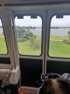
FYI, the MKTTC ferry boat is down due to sustained winds over 17 kn (20mph). I need to assume that other watercraft transportation, and possibly the Skyliner is down as well.
And FYI, buses and monorails, as well as Minnie Vans will suspend service if there are winds over 39 mph or in the event of catastrophic flooding.
What happens with guests in parks when winds are high enough to shut down monorail and buses too?
Cmdr_Crimson
Well-Known Member
Just waiting for the inevitable vlogger's "I'm stuck at WDW in a Hurricane. Oh, What shall I do?"
To That, I say what this sign is doing..

To That, I say what this sign is doing..
Vacationeer
Well-Known Member
- In the Parks
- No
About 5 times that amount now. 4:35p vs 10:17pm

Brian
Well-Known Member
11pm advisory. Landfall imminent.
ZCZC MIATCPAT4 ALL
TTAA00 KNHC DDHHMM
BULLETIN
Hurricane Helene Advisory Number 15
NWS National Hurricane Center Miami FL AL092024
1100 PM EDT Thu Sep 26 2024
...HURRICANE HELENE VERY CLOSE TO MAKING LANDFALL IN THE FLORIDA BIG
BEND...
...ACCOMPANIED BY A CATASTROPHIC STORM SURGE AND LIFE-THREATENING
WINDS...
SUMMARY OF 1100 PM EDT...0300 UTC...INFORMATION
-----------------------------------------------
LOCATION...29.9N 83.9W
ABOUT 75 MI...120 KM NW OF CEDAR KEY FLORIDA
ABOUT 40 MI...70 KM SE OF TALLAHASSEE FLORIDA
MAXIMUM SUSTAINED WINDS...140 MPH...220 KM/H
PRESENT MOVEMENT...NNE OR 15 DEGREES AT 24 MPH...39 KM/H
MINIMUM CENTRAL PRESSURE...938 MB...27.70 INCHES
WATCHES AND WARNINGS
--------------------
CHANGES WITH THIS ADVISORY:
None
SUMMARY OF WATCHES AND WARNINGS IN EFFECT:
A Storm Surge Warning is in effect for...
* Mexico Beach eastward and southward to Flamingo
* Tampa Bay
* Charlotte Harbor
A Hurricane Warning is in effect for...
* Anclote River to Mexico Beach
A Hurricane Watch is in effect for...
* Englewood to Anclote River, including Tampa Bay
A Tropical Storm Warning is in effect for...
* Florida Keys, including the Dry Tortugas
* Flamingo to Anclote River, including Tampa Bay
* West of Mexico Beach to the Okaloosa/Walton County Line
* Flamingo northward to Little River Inlet
* Lake Okeechobee
A Storm Surge Warning means there is a danger of life-threatening
inundation, from rising water moving inland from the coastline. For
a depiction of areas at risk, please see the National Weather
Service Storm Surge Watch/Warning Graphic, available at
hurricanes.gov. This is a life-threatening situation. Persons
located within these areas should take all necessary actions to
protect life and property from rising water and the potential for
other dangerous conditions. Promptly follow evacuation and other
instructions from local officials.
A Hurricane Warning means that hurricane conditions are expected
somewhere within the warning area.
A Tropical Storm Warning means that tropical storm conditions are
expected somewhere within the warning area.
A Hurricane Watch means that hurricane conditions are possible
within the watch area.
For storm information specific to your area in the United
States, including possible inland watches and warnings, please
monitor products issued by your local National Weather Service
forecast office. For storm information specific to your area
outside of the United States, please monitor products issued by
your national meteorological service.
DISCUSSION AND OUTLOOK
----------------------
At 1100 PM EDT (0300 UTC), the center of Hurricane Helene was
located near latitude 29.9 North, longitude 83.9 West. Helene is
moving toward the north-northeast near 24 mph (39 km/h). A turn
toward the north is expected overnight, taking the center over
Georgia. The center of the hurricane should make landfall
very soon in the Big Bend region of Florida. After landfall,
Helene is expected to turn northwestward and slow down over the
Tennessee Valley on Friday and Saturday.
Maximum sustained winds are near 140 mph (220 km/h) with higher
gusts. Helene is an extremely dangerous category 4 hurricane on
the Saffir-Simpson Hurricane Wind Scale. Weakening is expected
after Helene moves inland, but the fast forward speed will allow
strong, damaging winds, especially in gusts, to penetrate well
inland across the southeastern United States, including over the
higher terrain of the southern Appalachians.
Hurricane-force winds extend outward up to 60 miles (95 km) from the
center and tropical-storm-force winds extend outward up to 310 miles
(500 km). A sustained wind of 64 mph (103 km/h) with a gust to 84
mph (135 km/h) was recently reported at Cedar Key, Florida. A
gust of 83 mph (134 km/h) was recently reported at Steinhatchee,
Florida.
The estimated minimum central pressure based on Hurricane Hunter
aircraft observations is 938 mb (27.70 inches).
A NOAA National Ocean Service tide gauge located on Cedar Key
recently reported a water level of 7.33 feet above mean higher high
water.
HAZARDS AFFECTING LAND
----------------------
Key Messages for Helene can be found in the Tropical Cyclone
Discussion under AWIPS header MIATCDAT4 and WMO header WTNT44 KNHC
and on the web at hurricanes.gov/text/MIATCDAT4.shtml
STORM SURGE: The combination of a life-threatening storm surge and
the tide will cause normally dry areas near the coast to be flooded
by rising waters moving inland from the shoreline. The water could
reach the following heights above ground somewhere in the indicated
areas if the peak surge occurs at the time of high tide...
Carrabelle, FL to Suwannee River, FL...15-20 ft
Apalachicola, FL to Carrabelle, FL...10-15 ft
Suwannee River, FL to Chassahowitzka, FL...10-15 ft
Chassahowitzka, FL to Anclote River, FL...8-12 ft
Indian Pass, FL to Apalachicola, FL...6-10 ft
Anclote River, FL to Middle of Longboat Key, FL...5-8 ft
Tampa Bay...5-8 ft
Middle of Longboat Key, FL to Englewood, FL...4-7 ft
East of Mexico Beach, FL to Indian Pass, FL...3-5 ft
Englewood, FL to Flamingo, FL...3-5 ft
Charlotte Harbor...3-5 ft
The deepest water will occur along the immediate coast near and to
the east of the landfall location, where the surge will be
accompanied by large and dangerous waves. Surge-related flooding
depends on the relative timing of the surge and the tidal cycle,
and can vary greatly over short distances. For information
specific to your area, please see products issued by your local
National Weather Service forecast office.
For a complete depiction of areas at risk of storm surge inundation,
please see the National Weather Service Peak Storm Surge Graphic,
available at hurricanes.gov/graphics_at4.shtml?peakSurge.
WIND: Hurricane conditions are occurring within the hurricane
warning area. When the eye passes over, people are reminded to not
venture out into the relative calm, as hazardous winds will increase
very quickly when the eye passes. Tropical storm conditions are
occurring in southern and central Florida, and these conditions will
continue spreading northward across the tropical storm warning
areas in the Southeastern U.S. through early Friday. Strong,
damaging winds, especially in gusts, will likely penetrate as far
inland as the higher terrain of the southern Appalachians.
RAINFALL: Over portions of the Southeastern U.S. into the Southern
Appalachians, Helene is expected to produce total rain accumulations
of 6 to 12 inches, with isolated totals around 20 inches. This
rainfall will likely result in catastrophic and potentially
life-threatening flash and urban flooding, along with significant
river flooding. Numerous significant landslides are expected in
steep terrain across the southern Appalachians.
For a complete depiction of forecast rainfall associated with
Hurricane Helene, please see the National Weather Service Storm
Total Rainfall Graphic, available at
hurricanes.gov/graphics_at4.shtml?rainqpf and the Flash Flood Risk
graphic at hurricanes.gov/graphics_at4.shtml?ero.
For a list of rainfall observations (and wind reports) associated
this storm, see the companion storm summary at WBCSCCNS4 with the
WMO header ACUS44 KWBC or at the following link:
www.wpc.ncep.noaa.gov/discussions/nfdscc4.html.
TORNADOES: The risk for several tornadoes continues tonight through
early Friday morning over parts of north/central Florida, Georgia,
South Carolina, and southern North Carolina. The tornado risk will
persist Friday across the Carolinas and southern Virginia.
SURF: Swells generated by Helene will affect much of Florida and
the coasts of Georgia and the Carolinas during the next couple of
days. These swells are likely to cause life-threatening surf and
rip current conditions. Please consult products from your local
weather office.
NEXT ADVISORY
-------------
Next intermediate advisory at 200 AM EDT.
Next complete advisory at 500 AM EDT.
$$
Forecaster Pasch
NNNN
TalkingHead
Well-Known Member
Give the guy who predicted Steinhatchee a free Philharmagic Fastpass!
Register on WDWMAGIC. This sidebar will go away, and you'll see fewer ads.